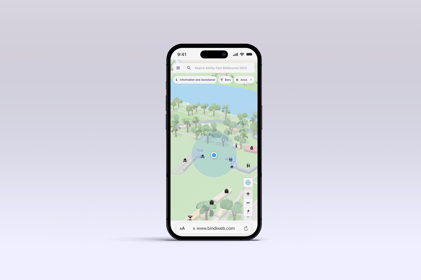
BindiWeb is breaking new ground—literally. Known for simplifying indoor navigation with no app required, our web-based interactive map now supports seamless outdoor navigation too. Whether accessed through a browser or embedded on websites, BindiWeb is redefining the way users explore, from building interiors to open spaces.
In our last update, we introduced Language Translations, supporting over 200 languages (read the blog post here), and now we’re making navigation smoother than ever with exciting new features that take you beyond the indoors.
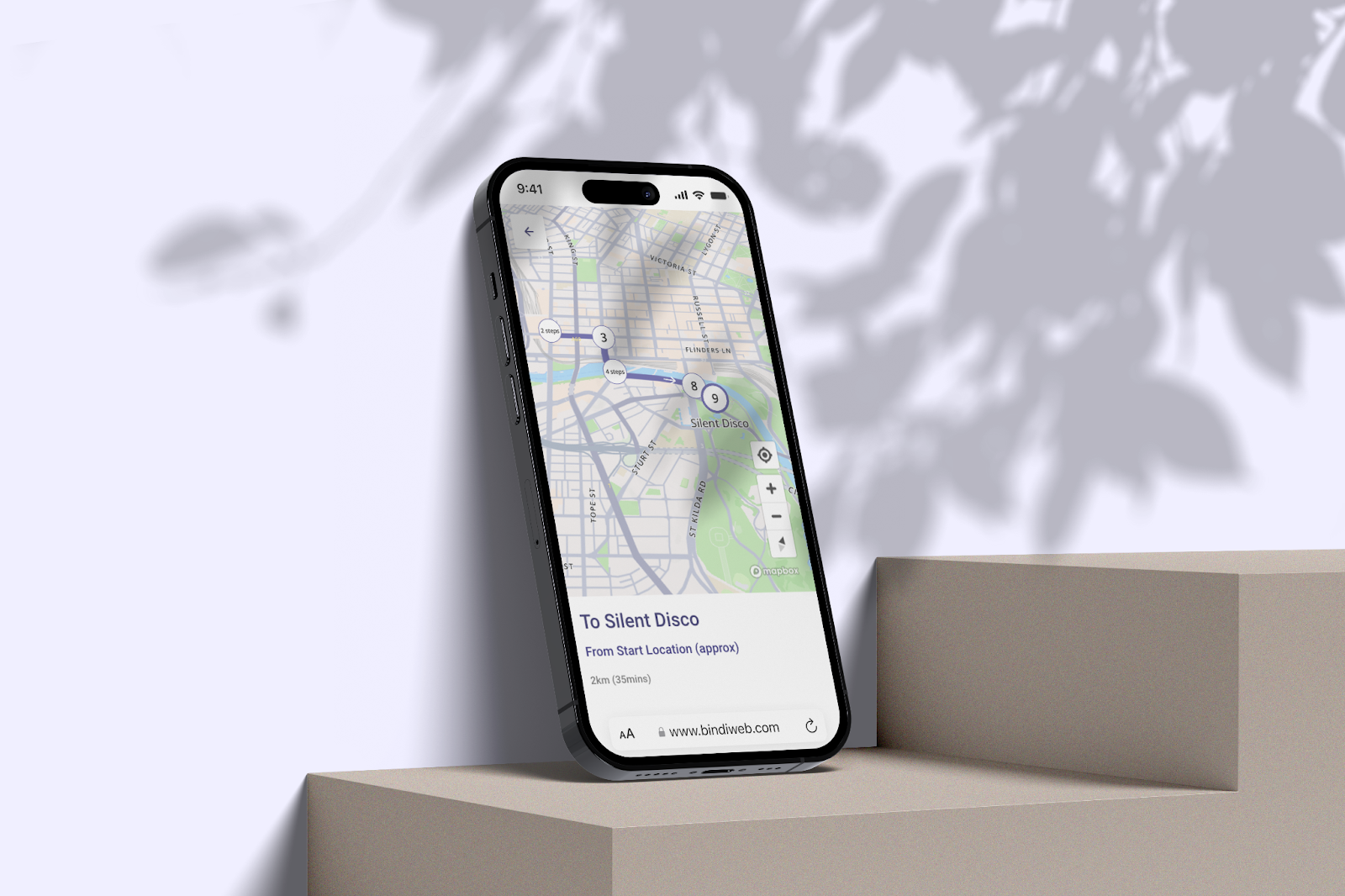
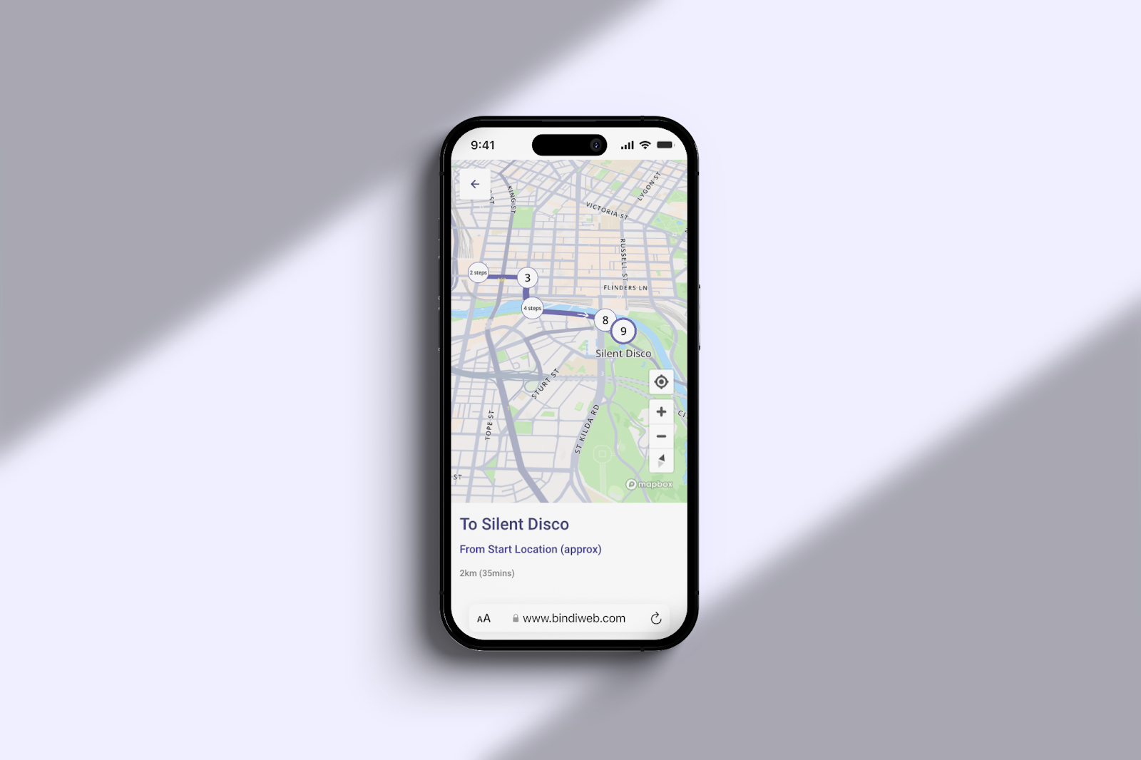
Outdoor Routing
The scope of navigable areas inside our BindiWeb maps has grown iteratively since we launched BindiWeb in 2022. Initially starting with a humble floorplan on a grey background, we evolved to overlay a location floor plan onto the map of the world and now we are taking this to the next level with outdoor routing support. Whether you are at a nearby train station or planning from home, you can now get the best route to your destination inside a location using BindiWeb.
Outdoor routing has consistently surfaced itself in our regular product research practice at BindiMaps, and we knew it would be the next evolution of our product. The appetite for outdoor navigation among users who are vision impaired was also a key insight we discovered from our Navigation & Technology survey;
88% of smartphone users with a vision impairment have used a navigation app outdoors, whereas 82% had used a navigation app indoors – Navigation & Technology Survey, BindiMaps, 2023
This insight also aligned with previous qualitative studies we have conducted, where participants shared their experiences navigating complex hospital environments. Many expressed a desire for comprehensive guidance that extends beyond just reaching a specific destination inside a building.
Recognizing these crucial insights, we understood that to truly empower our users in effectively planning their journeys to complex or unfamiliar locations, integrating outdoor navigation into our wayfinding offering was essential.
This new outdoor routing feature not only enriches our technology but also provides a more holistic approach to navigating the world and helping our users understand locations and spaces in a smarter way.
Alternate routes
Another new innovation to stem from our outdoor routing feature is the ability to customise your route through different transport modes. Users can choose to explore outdoor routes to a location via pedestrian, car, cycling or public transport modes. Our alternate routes feature empowers our users with further customisations depending on how they prefer to travel.
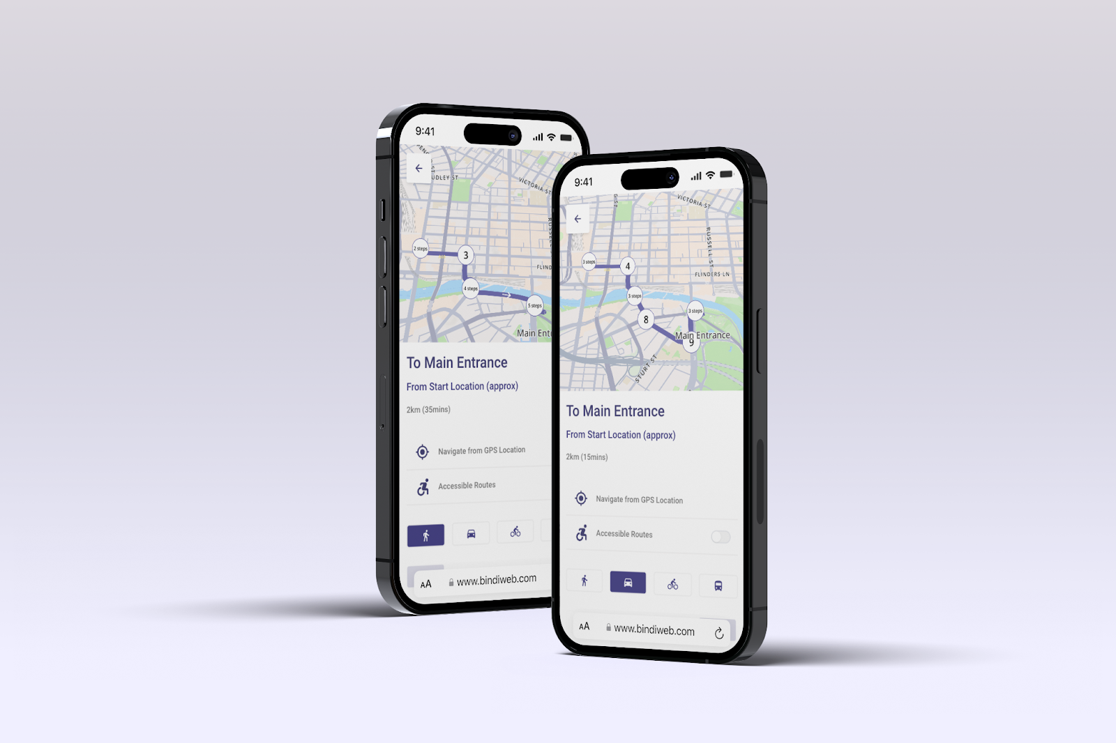
Approximate Navigation Time
BindiWeb already displays distance to a destination, but for some users, distance alone doesn’t provide enough context for their journey planning. In this release, we’ve introduced approximate navigation time to help users better gauge how long their trip will take. Time is a more intuitive and universal metric for most people, making it easier to manage expectations about their journey length and overall experience.
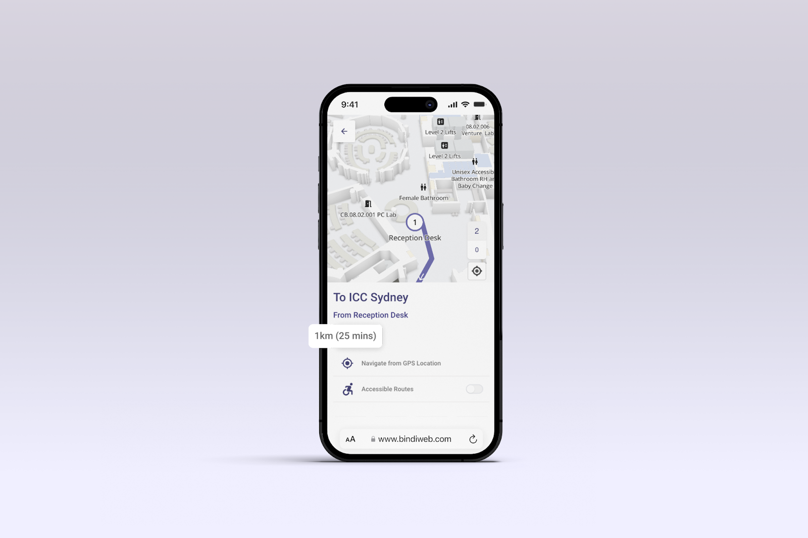
GPS Localisation
Localisation is a key ingredient to wayfinding, which is why in this latest BindiWeb release, we have integrated GPS localisation as a new feature, enhancing the wayfinding experience for users who wish to know where they are in the world using BindiWeb.
When exploring a route to a destination, users can now choose to start from their own GPS location, optimising routing to be more contextual and useful for users who are nearby to a BindiMaps supported location.
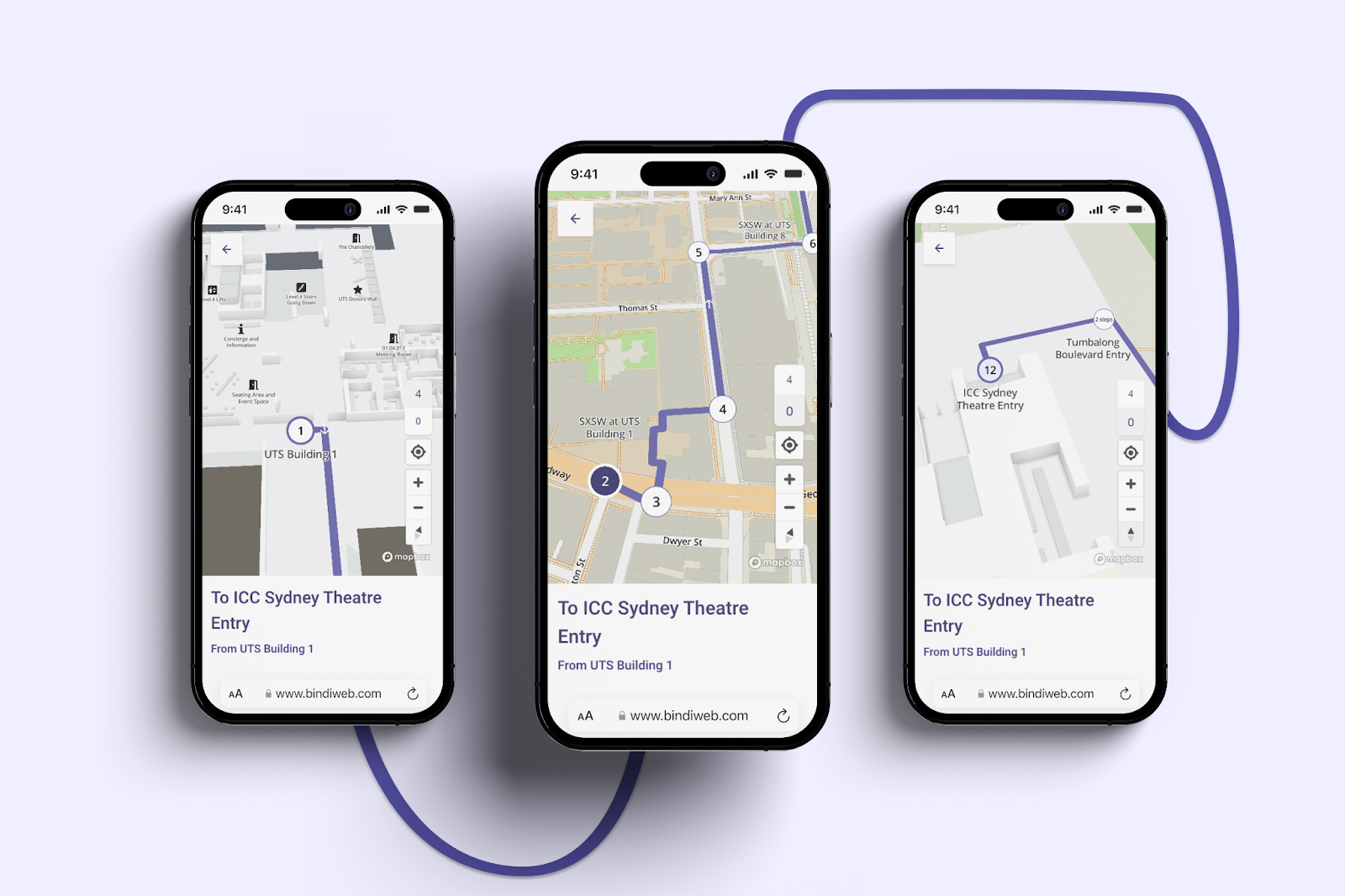
Cross-Location routing
Outdoor navigation brings unique challenges, especially when moving from indoors to outdoors, crossing roads, catching public transport, and then heading back inside another location. With our new Cross-Location Routing, users can seamlessly navigate across complex environments.
We are particularly excited about this feature, as it unlocks new possibilities for large-scale locations like university campuses and cross-city events—just like the Sydney SXSW (Check out SXSW on BindiWeb here).
With each release, BindiWeb continues to evolve, making navigation smarter, more intuitive, and accessible to all users. From seamless outdoor routing to GPS localisation, our goal is to make navigating your location simpler, smarter, and more accessible for everyone. We’re excited about the new possibilities these innovations bring. Stay tuned for more updates as we continue to refine and expand BindiWeb, empowering you to explore the world with ease.


