

ABOUT US
BINDIMAPS TIMELINE
Listed below is a chronology of the BindiMaps Journey from inception in 2017 to the present.
![Bindimaps Origin Moment]()
2017 - BINDIMAPS WAS BORN
BindiMaps was founded in 2017 to answer a key unanswered question:
Why hasn't anyone made Google Maps work indoors?
The business set out to solve a niche problem sighted people rarely notice. Once you are through the front door, wayfinding tools built for the outside world simply stop working!
![Government Funding Allocation Visual Representation]()
2021/22 - EVOLUTION OF TECHNOLOGY
The evolution of technology took a major step forward under the NSW Government's Small Business Innovation & Research program, funded by the NSW Office of the Chief Scientist and Engineer.
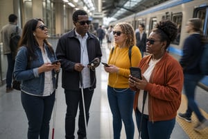
Finalising in Phase 2 proof-of-concept application in March–April 2022.![Blind Individuals Holding Mobile Devices in Metro Station]()
2023/24 - PROOF OF CONCEPT DEVELOPMENT
Between 2023 and June 2024, that Phase 2 proof of concept from 2022 was built and trialled at Castle Hill Metro Station, with Transport for NSW as the challenge agency setting the accuracy bar at 30cm.
The trial's defining moment came when Ben Moxey — Access and Technology Advisor at Guide Dogs NSW/ACT, and himself totally blind — navigated independently from the street entrance down two levels to a specific platform door, proving hyperlocal, beacon-free positioning could work exactly where GPS can't: underground.
![No More Bluetooth Beacons in Corporate Office Building]()
2024 - FIRST COMMERICAL INFRASTRUCTURE FREE DEPLOYMENT
The proof of concept led straight into BindiMaps' first commercial deployment: Australia Post signed on as the first commercial customer, going live at 500 Bourke Street in August 2024.OCTOBER 2025 - A NEW CHAPTER
In late 2025, it became apparent the original sole focus of the Blind and Vision Impaired (BVI) became financially unsustainable under the direction of the original founders of the business, and a delayed R&D tax incentive refund put pressure BindiMaps couldn't absorb, and the company entered voluntary administration. Rather than an ending, it became a turning point: new owners (Bret Duckers & Linas Jarasius) acquired the business out of administration in October 2025, keeping the technology, the mission, and the core team intact. Setting BindiMaps up for its next chapter, reaching beyond its original accessibility-first user base into hospitals, universities and retail everywhere.2026 - NEW WEBSITE, NEW PRODUCTS
That new chapter arrived in 2026 with a relaunched website and a refreshed product lineup: the BindiMaps App became TruStep, and BindiView became PathView and PathView+ — the same infrastructure-free, beacon-free navigation, sharper and easier to recognise than ever.



I believe every complex space - a hospital, an airport, a stadium, a train station at rush hour - should be as easy to navigate as the street outside it. That's the standard BindiMaps was built to, proven with the community who needed it most: people who are blind or visually impaired, navigating with an accuracy and confidence GPS could never give them underground.
Our strategy now is to bring that same infrastructure-free, beacon-free technology to every organisation with a complex space and every person who walks through it - because accessible design isn't a feature for some people, it's better navigation for everyone. That's what we're building, every day.